
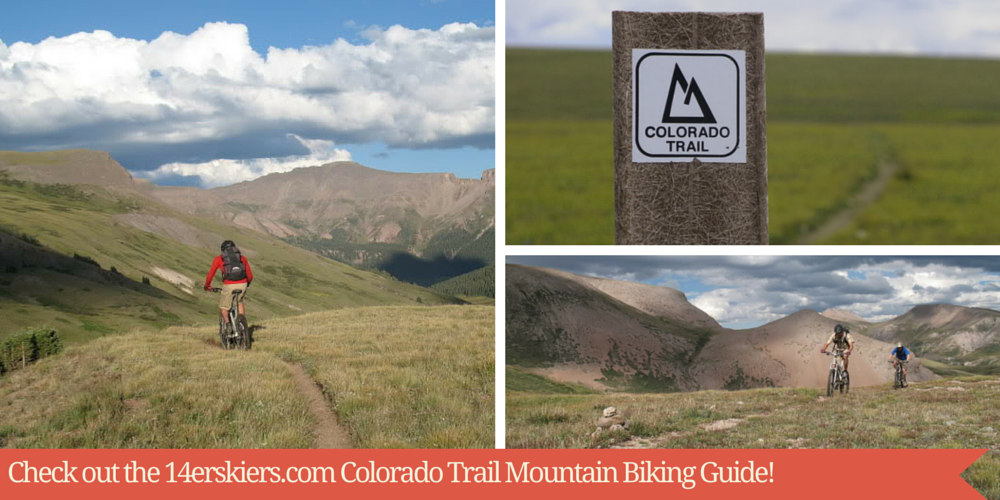
Colorado Trail Mountain Bike Guide
The Colorado Trail (CT) may very well be the best long distance trail open to mountain bikers. Stretching nearly 500 miles between Denver and Durango, with an elevation change of nearly 90,000′ and a high point of 13,200′, it is one trail that can actually be described using the overused word “epic”. Of course, the entire trail isn’t open to mountain bikes, due to a number of sections that enter Wilderness areas, but the open sections are almost always high quality singletrack.
Recently, I have made it a personal goal to ride ALL of the CT that lies outside Wilderness areas. This means that if there is a 2 mile section that is outside of a legal Wilderness, I plan on riding it. There are many ways to do this. One method is to ride the trail in one push with camping gear (aka bikepacking or thru-biking), perhaps as part of the Colorado Trail Race, though this route misses many portions of the CT. Another great option would be to ride the entire trail in one push with a group of friends and a support vehicle carrying camping gear and a cooler full of post-ride beers, which would again miss quite a bit of trail. Then there’s the alternative I’ll be pursuing- which is to ride each section of the CT separately.
For me, this option is the easiest one logistically, and allows me to ride each section in the best direction possible (i.e. towards Denver or towards Durango). Additionally, it gives me the ability to combine the CT with other trails and create some terrific loops. Last but not least, I already have a head start, since I first rode some sections of the CT way back in the early 90’s.
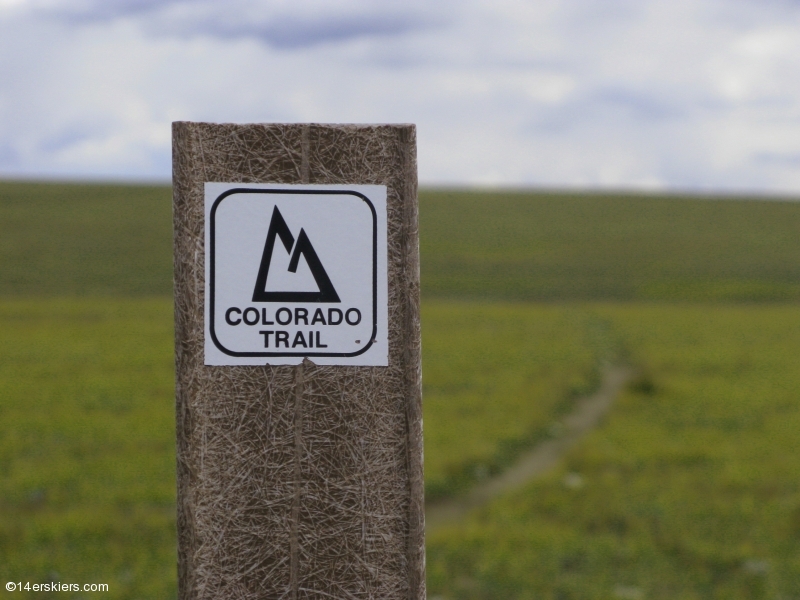
So, to that end, here’s my Colorado Trail Mountain Bike guide. Hopefully the holes in this list will be filled soon. Whenever possible, I will suggest loops, shuttles, or the best direction to ride each section. The guide is organized section by section in the same way as the Colorado Trail Guidebook, which is a terrific resource offered by the Colorado Trail Foundation. Speaking of the Colorado Trail Foundation (CTF), if you enjoy the CT consider donating some of your time or money to the CTF, since they are the ones who help keep the trail in such terrific shape.
The value of this page will be greatly enhanced by comments from 14erskiers’ readers. One of the draws of this project for me is that I get to pour over maps and attempt to discover the best way of riding a section- whether it’s an out and back, a shuttle, or a loop with other trails and roads. So if our readers know that a route I have proposed isn’t feasible or the best route available, please let me know by leaving a comment here.
Looking for a thru-bike report? Click HERE for a guest blog entry.
| One final note. This guide took a tremendous amount of work. If you find it useful, please consider purchasing an item through one of our affiliates or contributing a small donation to us through paypal, using the button at right. Thanks! |
Section 1: Waterton Canyon to South Platte CanyonDescription: This section is not only the first section of trail in the Den-Dur direction, it’s also the first section of the CT I ever rode- way back in high school on a fully rigid bike. A number of great loops can also be ridden in the area, such as the trails in Roxborough Park. For the purposes of my CT project, I shuttled this section along with the next one for an incredible day out. Route: CT from Little Scraggy to Waterton Canyon
|
|||||
Section 2: South Platte Canyon to Little ScraggyDescription: The second section of the CT enters the Buffalo Creek Fire area and is mostly flat and gravelly, as is the third section. It is a great section of trail, winding in and out of the burn area through multiple drainages and ridges. One I could ride again and again. Route: CT from Little Scraggy to Waterton Canyon
|
|||||
Section 3: Little Scraggy to Wellington Lake RoadDescription: The third section of the CT is undoubtedly one of the most popular amongst riders, as it is the backbone of the Buffalo Creek riding area. Like the first section, there are numerous loop opportunities in this area. Buffalo Creek trails are known for being fast, flowy, and the soil tends to be crushed granite. Combined with the other trails in the area, this is one of the CT’s finest sections. I recently rode this section one way- including the short non-wilderness part of the following segment. On the way back, we exited the CT to ride Redskin-Gashouse-Morrison Creek-Shinglemill-Sandy Wash. This made for an great tour de Buffalo Creek that included all of the CT. Route: See above
|
|||||
Section 4: Wellington Lake Road to Long GulchDescription: This section lies primarily within the Lost Creek Wilderness, however there are 2 short sections outside the Wilderness area. The first one is a quick 1.9 miles, which can be tacked on while riding the CT in segment 3. Another 8.4 miles is on the other end, at the Long Gulch trailhead. both can be ridden as out and back rides. Route: CT out and back
|
|||||
Section 5: Kenosha Pass to Wilderness BoundaryDescription: This majority of this section is in legal Wilderness. The section that isn’t in Wilderness, however, makes for a great quick out and back. This section is spectacular in the fall, when the leaves are changing. Route: Out and back
|
|||||
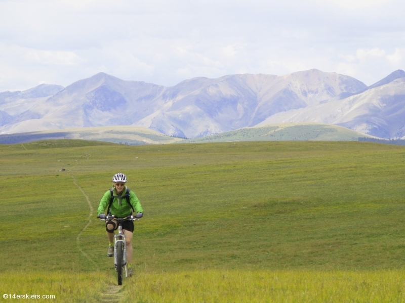
Section 6: Kenosha Pass to Gold HillDescription: This long section is one of the finest of the Colorado Trail. Riding from Kenosha Pass to Georgia Pass with the Aspen leaves changing is one of the rites of fall for many riders. Meanwhile, the other end of this section, in Summit County, can be linked up with other trails to create some of the best loops in the area. The Summit county side of Georgia Pass can be reached via a number of routes, including a loop involving French Pass which will remain on a list of things to do for now. You could spend a week in this area doing different loops on the CT. Route: Multiple
|
|||||
Section 7: Gold Hill to Copper MountainDescription:Early editions of the Colorado Trail Race skipped this section, and for good reason. The majority of the 4+ miles of the CT from the Peaks trail to the 12,500′ high point are hike a bike. Thru-bikers may easily take 5 or 6 hours to do this short segment, and may want to at least consider riding the rec path from Gold Hill through Frisco and over to Copper, as the early CTR’s did. The best way to cover all the miles of the CT on this segment if you are splitting the CT into day rides as I am, would be to split it into two rides. 1- Up the Wheeler trail from Breckenridge and down Miner’s creek to Gold Hill. 2- Up the Wheeler trail and down the CT to Copper. Going up Miner’s creek is brutal and I will not do it again unless I do the CTR some day. Route: Multiple choices, but I rode from Gold Hill to Copper as part of a big shuttle ride.
|
|||||
Section 8: Copper Mountain To Tennessee PassDescription: This is an incredible section and shouldn’t be missed. I ended up splitting it up into 2 segments, and I would recommend this plan of attack. The first ride was from Copper Mountain to Elk Ridge, the high point of this segment, as an out and back. The descent from Searle Pass to Copper is exceptional, which is one reason to consider splitting this section into two. Next, I rode from Tennessee Pass to Elk ridge. Tennessee Pass to Camp Hale is again quite exceptional, but the climb from Camp Hale to Elk ridge is brutal with a fair amount of hike-a-bike. The descent back to Camp Hale is good, but not as good as Searle-Copper. If I were to do it again: 1)Copper to Searle and back. 2)Copper to Camp Hale with a shuttle or following FS 714 to Hwy 91 and back to Copper. This is a very doable ride without a shuttle. 3)Camp Hale to Route: na
|
|||||
Section 9: Tennessee Pass to Timberline LakeDescription: This section is the tale of two trails. Within the first 3 or 4 miles you will find some sections of singletrack that rival any singletrack, anywhere. The final 3 miles to the Wilderness boundary are quite technical and difficult, with embedded rock gardens requiring all your skills and attention. Still a blast, just different from the playful and loamy first part of the ride. The views from the Wilderness boundary are superb, and will make you sad that you cannot enter the Holy Cross Wilderness. Route: CT to Wilderness boundary and back.
|
|||||
Section 10: Timberline Lake to Mt MassiveDescription: This short section may not seem worth it, but I’m glad this project led me to it, as it defines “short and sweet”. This formerly glaciated area is a rock garden lover’s dream- very technical but doable and fun. Definitely exceeded my expectations. Route: CT to Wilderness boundary and back.
|
|||||
Section 11: Section 11: Mt Massive to Clear CreekDescription: This is a great section, most easily done with a shuttle between trailheads. I often ride part of it in conjunction with Mt. Elbert. This section works best in the Den-Dur direction, although it could certainly be done as an out and back (the climbs from both reservoirs would be tough in the Dur-Den direction.) Sadly, we didn’t have time to tack on the 1.8 miles of the following section, which would obviously be ideal. Route: na
|
|||||
Section 12: Clear Creek to North Cottonwood CreekDescription: This section has a small amount of non-Wilderness trail at each end. 1.8 miles should be ridden with the previous section, while a 3.1 mile section is outside Wilderness at the end of this section. Meanwhile, it’s only a 2.7 mile section on the next section before it re-enters wilderness, so if I play by the rules I guess I’ll ride this little ~6 mile section as an out and back. Route: na
|
|||||
Section 13: North Cottonwood Creek to Chalk CreekDescription: I’ve ridden the majority of this section, and it’s yet another great one. Previously, I’ve ridden the Frontier Ranch to Rainbow lake section as a loop utilizing Chaffee county roads in the Arkansas valley, but Brittany pointed out the last time we rode it that this section would probably be just as good as an out and back. Route: Out and back from Cottonwood Pass road.
|
|||||
Section 14: Chalk Creek to Highway 50Description: This is the only section of the CT that I’ve been on that I didn’t like. It’s constantly up and down, with plenty of hike-a-bike and babyheads, and takes a lot longer than it seems like it might. One of my partners that day got so aggravated he ended up throwing his bike, while I ended up getting an X-ray on my wrist (it wasn’t broken). We ran shuttle from Raspberry Gulch to Highway 50, which means I’ll need to go back for the first 3.9 miles of this section. Route: best as a shuttle.
|
|||||
Section 15: Highway 50 to Marshall PassDescription: When the CT racers race from Denver to Durango, they end up having to hike-a-bike up Fooses Creek. Which must be demoralizing because descending Fooses in the opposite direction is simply a screamer of a downhill. The classic Monarch Crest ride fills out the other part of this section. Riders looking to do the whole section in one ride should consider running shuttle from Poncha springs to the top of Marshall Pass. Route: best as a shuttle.
|
|||||
Section 16: Marshall Pass to Sargents MesaDescription: It took a long time to finally find out just what lies beyond the Silver Creek turnoff on the popular Monarch Crest route. As it turns out, there is some great riding on this section of the CT, with nearly every type of riding present and a bit of a wilderness feel. Once I turned off the CT onto the Long Branch trail, I was confronted with a steep and rocky trail that I found to be quite fun in a technical adventure ride kind of way. Worth a look for sure. Route: Marshall Pass road (243) to CT to Long Branch trail/road (489/780)
|
|||||
Section 17: Sargents Mesa to Hwy 114Description: Ask anyone who has completed the Colorado Trail which section was their least favorite to ride, and “Sargents Mesa” comes up constantly. This section was one that I wasn’t necessarily looking forward to, as its reputation is that of an up and down babyhead festival of fun. I actually enjoyed it, though, and thought it was much better than its reputation implies. With several trails that connect to this section, like Long Branch, Big Bend, and Dutchman’s (the latter somewhat popular with Gunnison area riders), this area is worth a look if you enjoy difficult and at times technical riding. If you’re looking for baby-butt smooth trails, this is definitely not your area. Route: CT from Hwy 114 to the Big Bend Trail all the way to Sargents
|
|||||
Section 18: Hwy 114 to Saguache ParkDescription: Heading towards Denver, this section covers a lot of road miles before entering some nice forest land and a few miles of singletrack before the highway. Not the greatest segment, but not the worst, either. Route: Saguache Park to Hwy 114
|
|||||
Section 19: Saguache Park to EddiesvilleDescription: 7 of the 11 miles (one way) of this ride are on roads in the cattle country of the Cochetopa Hills. As such, it is far from the best segment on the Colorado Trail, though it isn’t without it’s own unique charms. Route: CT Out and Back
|
|||||
Section 20: Eddiesville to San Luis PassDescription: This section is legal Wilderness and as such is not rideable. It is the only segment entirely in Wilderness. Route: na
|
|||||
Section 21: San Luis Pass to Spring Creek PassDescription: The legal part of this segment that lies outside Wilderness is one of my favorite parts of the CT. With a long shuttle, and combined with the Miner’s Creek trail, this is simply spectacular alpine riding. Thru-bikers miss out on this section, which is really a shame. Route: Colorado trail to Miner’s Creek 803
|
|||||
Section 22: Spring Creek Pass to Carson SaddleDescription: Like the sections around it, this is high alpine riding- in fact the CT reaches a high point of 13,271′ here. Ideally, I’d like to run a long shuttle from Spring Creek pass down to the Lost Creek trailhead, which is where I normally start section 23, and ride ALL DAY long above treeline to Stony Pass. A more feasible option would be to start at Lake San Cristobal, ride up Wager Gulch to the CT, head towards Denver, and take the highway back from Spring Creek to the lake. A friend of mine reports that this section is indeed better in the Dur-Den direction. I was able to run shuttle and ride part of 23 before dropping towards the Lake Fork of the Gunnison. Route: Spring Creek to Carson Saddle
|
|||||
Section 23: Carson Saddle to Stony PassDescription: When I get bored with riding, all I have to do is think of this trail to get stoked again. It is my favorite trail in the world. The entire section is above treeline, need I say more? I like to ride it as a loop (see the link), but that misses the last 3 miles or so. I guess I’ll have to finish it off to Stony Pass next time. If I have to… (YES!) It might even be fun as an out and back. Route: Lost Trail-CT-Stony Pass
|
|||||
Section 24: Stony Pass to Molas PassDescription: The CT enters Wilderness at Stony Pass. As far as I know, one can descend 2,000′ or so in 5.8 miles down to the Wilderness from Molas. It won’t be fun coming back out though… Route: CT out and back
|
|||||
Section 25: Molas Pass to Bolam PassDescription: The end of the CT is incredible- each section from Molas Pass to Durango is a classic. This segment traverses high alpine and subalpine terrain and connects with many classic trails such as Engineer, Cascade, and Hermosa Creek. The descents off of saddles at miles 11.2 and 19.1 will keep your spirits up if the scenery somehow isn’t. Route: Molas Pass to Hotel Draw (segments 25 and 26)
|
|||||
Section 26: Bolam Pass to Hotel DrawDescription: The end of the CT is incredible- each section from Molas Pass to Durango is a classic. The key feature of this segment is Blackhawk pass, a surprisingly rideable alpine pass followed up with an amazing descent. Route: Molas Pass to Hotel Draw (segments 25 and 26)
|
|||||
Section 27: Hotel Draw to Kennebec PassDescription: The end of the CT is incredible- each section from Molas Pass to Durango is a classic. The Colorado Trail isn’t the only attraction in this area- a number of great trails drop off the CT. This section features the infamous Indian trail Ridge alpine section. Route: na
|
|||||
Section 28: Kennebec Pass to Junction CreekDescription: The end of the CT is incredible- each section from Molas Pass to Durango is a classic. One great way to ride this section is to ride up Kennebec Pass road and descend the trail, although I was able to do it as part of a big 2 day mission from Molas Pass. A great, short loop can be made at the end of the trail using the dry fork trail. Route: na
|

- Bluebird Backcountry Ski Area - February 14, 2020
- Gear Review: Smith 4D MAG Goggles - January 6, 2020
- Gear Review: LEKI Tour Stick Vario Carbon Ski Poles - December 9, 2019