(Last Updated On: )Please enjoy this guest blog post brought to you from Alaska by our friend Mike Records! – Brittany
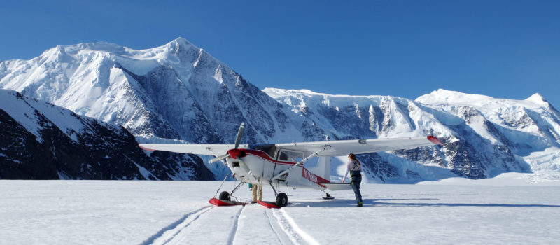
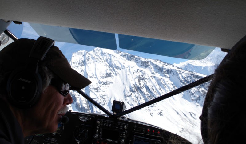
Marcus Baker is scary. Rising 13,000 feet straight out of the Prince William Sound, it turns benign southerly winds into storms, storms into blizzards, and blizzards into monsters. There are so many stories: 11 days in a snow cave, snow caves filling in too fast to dig out, time to dig mansions underground. So, when forecast run after forecast run showed a strong high pressure window forming, the destination seemed obvious. Next up was putting together a last minute team with the requisite rope, glacier, skiing, and avalanche experience for a smash and grab mission. Mary and Sarah were available, and as usual, up for anything. After a frantic night of packing we pulled into Mike Meekin’s Sheep Mountain air strip 8 AM on Friday. First, Mike would take me out with the gear, then the ladies would follow. Lifting off the gravel airstrip above budding trees it was hard to believe it could be winter anywhere. 5 minutes later, the cracked surface of the Matanuska Glacier was below us.
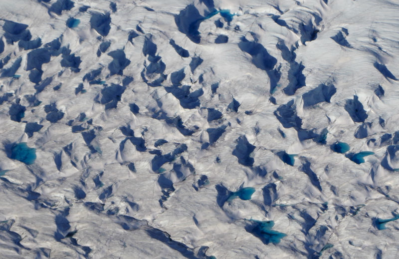
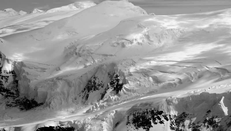
Melt ponds already forming on the glacier surface:
Mike briefly distracted me from the scenery because he had just returned from a packraft/SuperCub brown bear hunt that he had to show me pictures of. Looking up from his phone, the glacier started to curve away to the south.
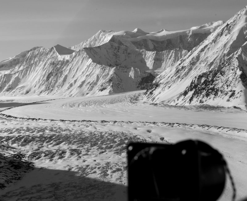
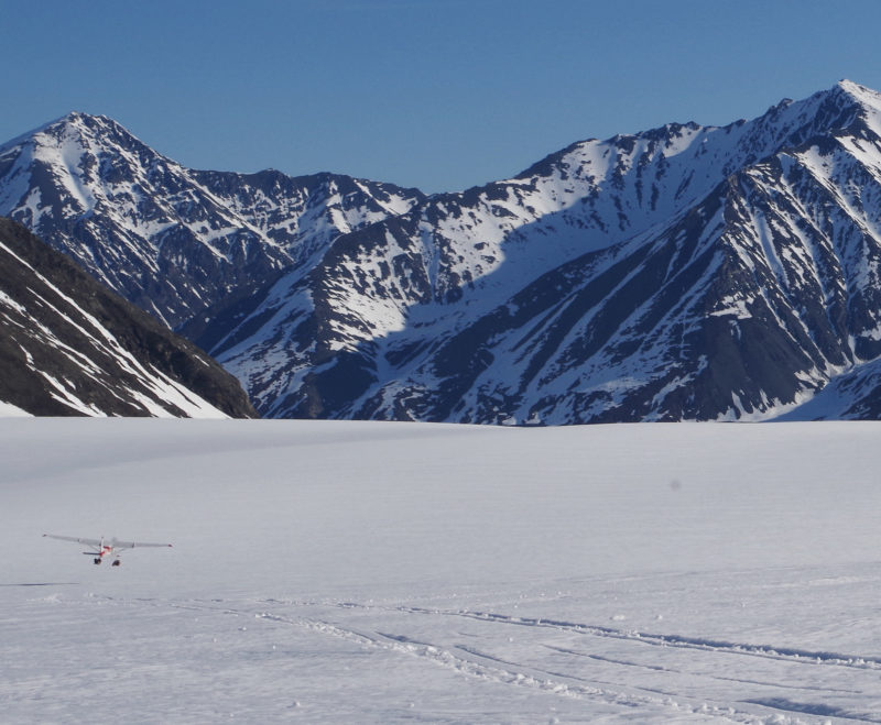
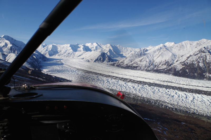
Then the gorge came into view:
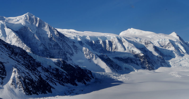
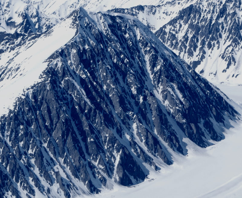
And then the Marcus Backer massif.
We set down at 5,500 feet, threw out the gear, I received several enthusiastic pats on the back, and he was gone.
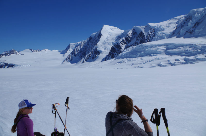
Just as I was settling into a nice nap complete with serac fall for white noise, they were back.
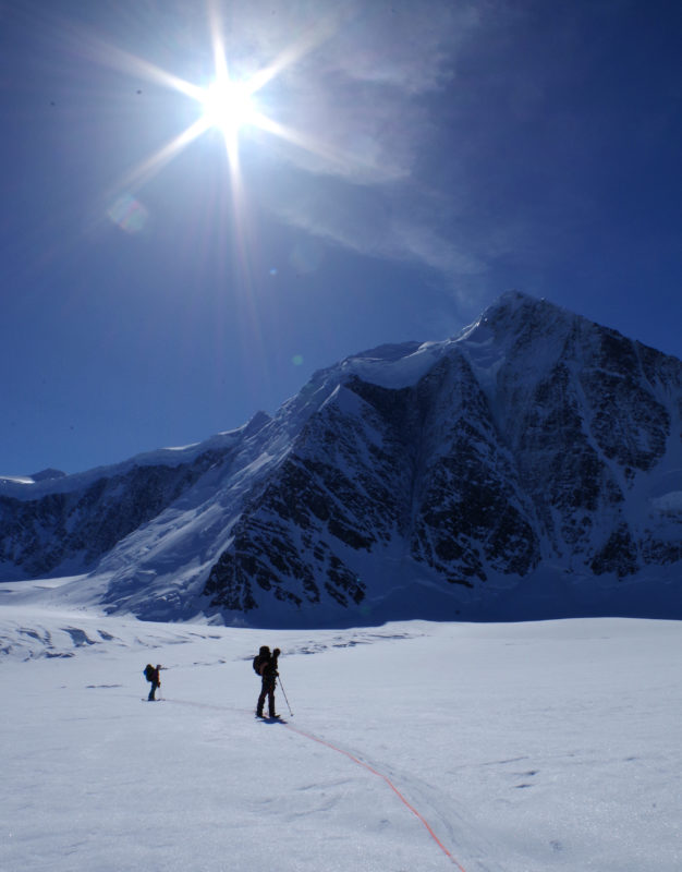
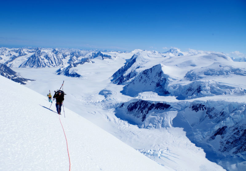
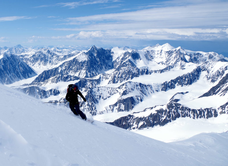
Beginning to skin up the Matanuska was a jaw dropping experience. Seracs 500 feet tall stood on top of 2,000 foot cliff faces. Forward progress was efficient, occasionally pausing to probe suspicious dips, and to zig-zag around open crevasses.
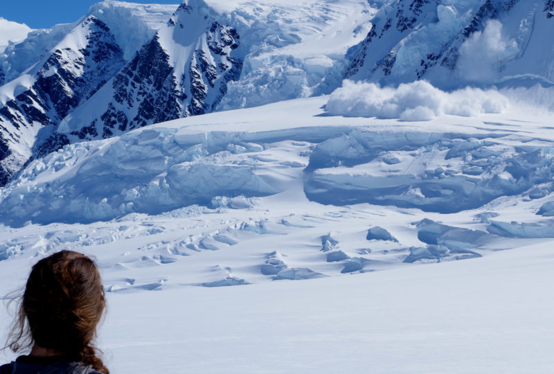
Every few minutes thundering booms announced another serac fall releasing tumbling blocks the size of houses.
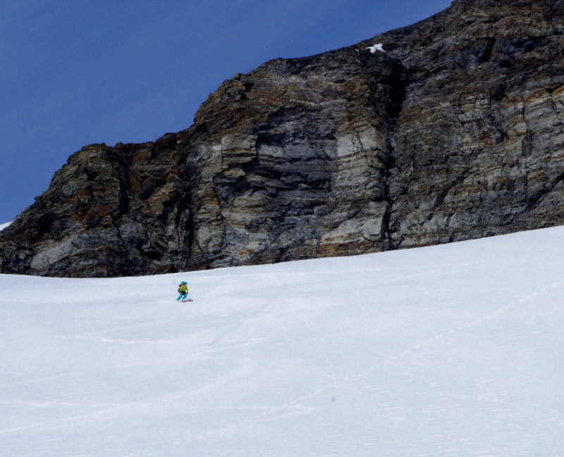
By lunch time we had left the mellow glacier behind and reached avy terrain.
Now more concerned about avalanche hazard, we removed the rope and started to quickly gain elevation. Mary:
Around 3:45, the terrain and snow surface became more complex and suspicious. I got out my probe, probed once, then the snow bridge below me promptly failed. Caught by a foot on one side and an arm on the other, I could see 25 feet down to where the failed snow bridge was jammed below me. More alarming was the water cascading into the abyss.
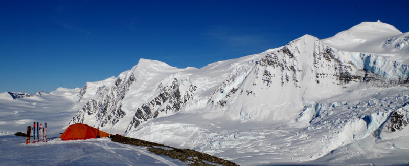
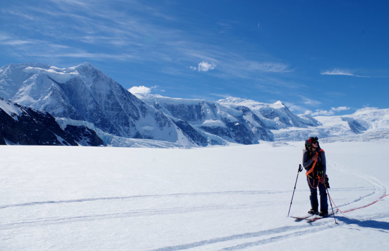
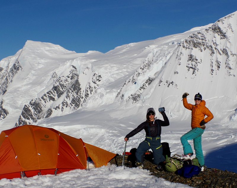
Clearly, it was getting too late in the day to trust the snow bridges. You’re never going to hit a perfect window on Marcus Baker, if it hadn’t been weak snow bridges it would have been snow, wind, or instability. So, Mary lead us back until we could safely egress from the glacier, then continued up along the edge of the moraine. 45 minutes later we ran out of ice-free terrain. Needing a solid freeze to move higher, it was time to find a camp. Which received the Sarah & Mary stamp of approval:
That night, while the tent flapped in the wind, Sarah and I discovered that our pads were leaking, and Mary rediscovered the joys of being on the downhill side of the tent. By 5 AM Sarah had us up and getting ready. Apparently there was a beautiful sunrise, my brain was asleep, but what Sarah described was lovely.
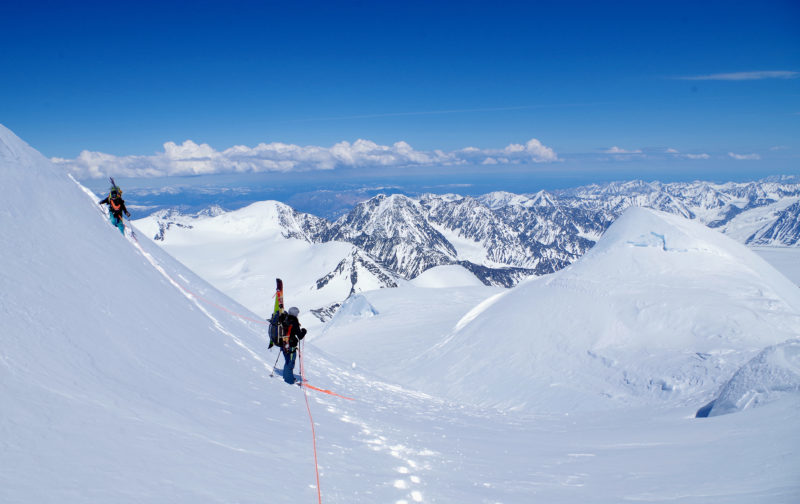
Heading out of camp, the soft snow bridges had refrozen overnight. But, the freeze was bittersweet: the hard snow made for slippery and aggravating skinning conditions. After two hours of fast progress, the slippery skinning became impossible and dangerous as we entered steeper and more crevassed terrain. At this point we switched to booting.
Booting had its own challenges, it was great on sections of ice, but slow and challenging when the snow became softer and deeper, and there was the increased hazard of breaking through a bridge. Mary with the Icing Peak just out of sight to the right:
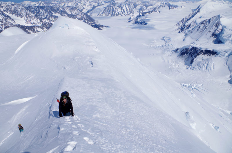
At about 10,000 feet the snow surface was again soft enough to skin. Skinning was an emotional relief after the business of plodding. This didn’t last long – as Sarah lead across a ridge, she was whisked off her feet by more ice.
Moving into more continuous and steeper ice, booting was clearly the safer option. Ahead was a false summit that we decided to contour left around. This started with an exciting lunge across an open bergshrund. A few minutes later my foot broke through the brittle ice into a hole below. Unweighting and pulling it out, there was a dark void below.
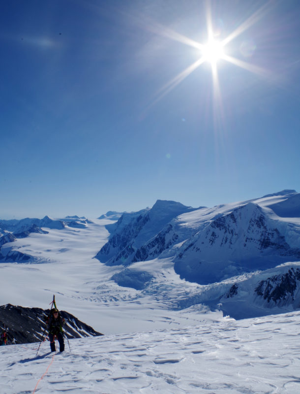
Finishing the complex traverse, the north peak of Marcus Baker came into view. Everyone was a bit frazzled and took a break to melt water, eat lunch, and relax.
Refreshed we kept moving up. Probing our way across a big bergshrund brought us to just short of the summit. Looking back at our lunch spot and the better route around the false:
From lunch, the final west ridge had seemed like the least exposed option, but popping my head over, it was 2,000 feet straight down from the knife edge to the Marcus Baker Glacier. I retreated and tried the north ridge instead. Again, we had to lunge across an open bershrund before climbing steep rime to the ridge.
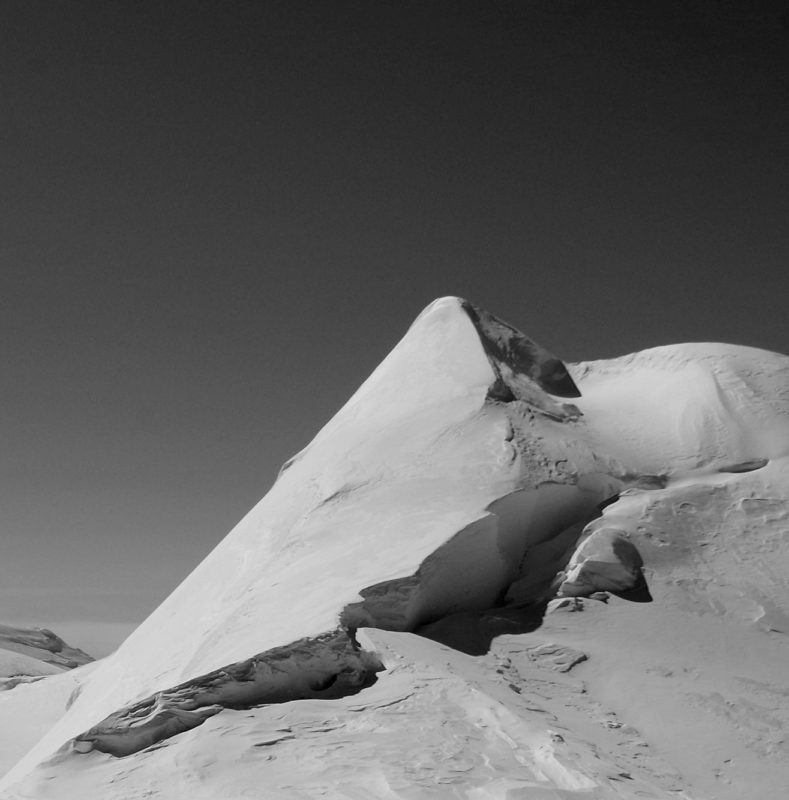
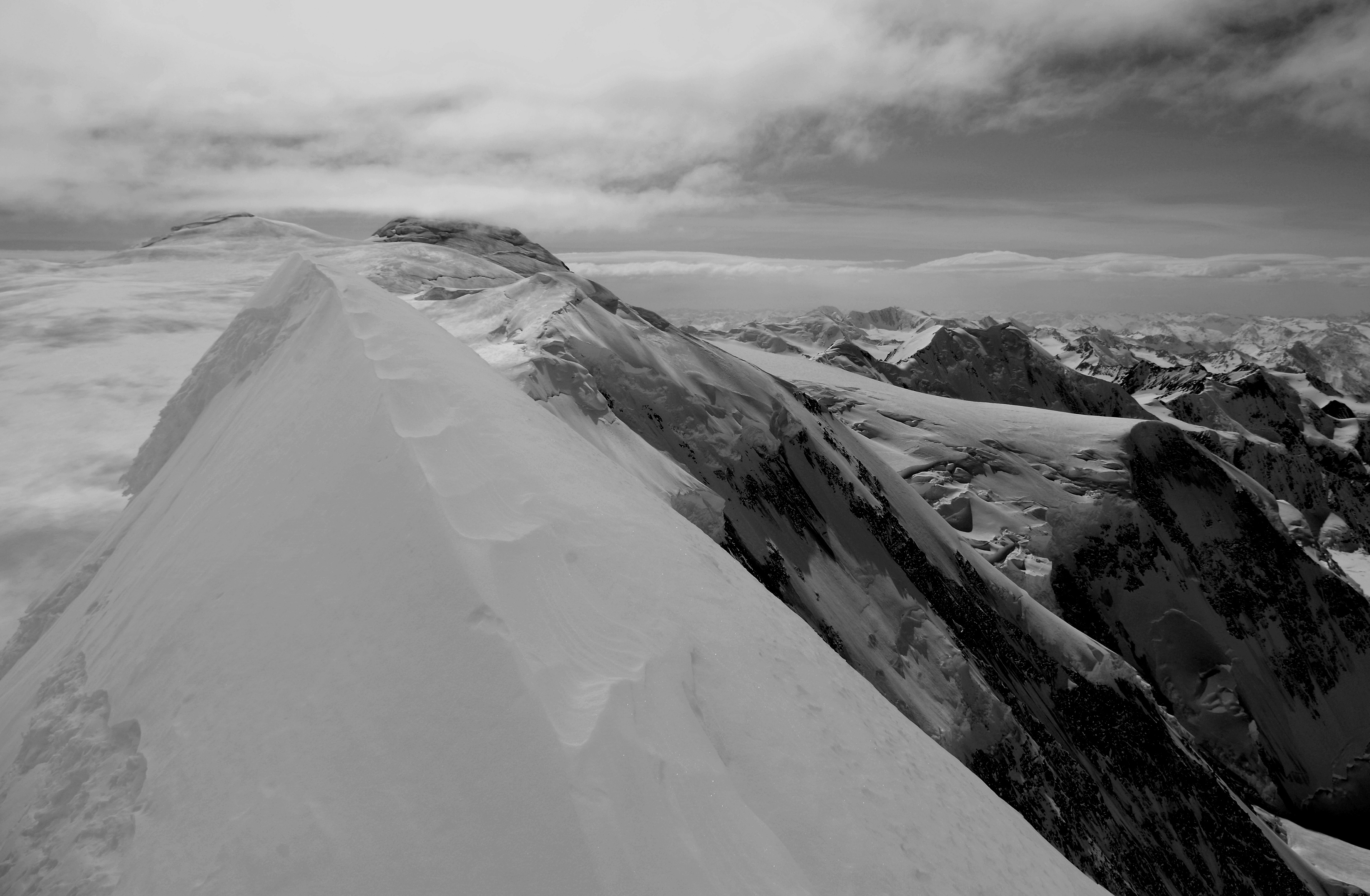
Then there was the top: a dramatic two dimensional blade falling away on either side. To the east was 1,500 jumbled feet of seracs, crevasses, and ice; to the west a 2,000 foot cliff dropped away.
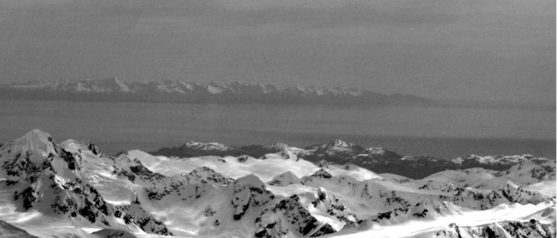
Way off to the south there was Montague Island and the Prince William Sound:
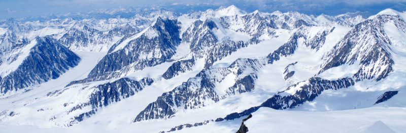
An intriguing 3,000 foot wall of couloirs on a tributary of the Marcus Baker Glacier:
The view west into the dry side of the Chugach, the rain shadow of the coastal giants is obvious here.
Especially when compared to the huge ice fields rising out of the ocean:
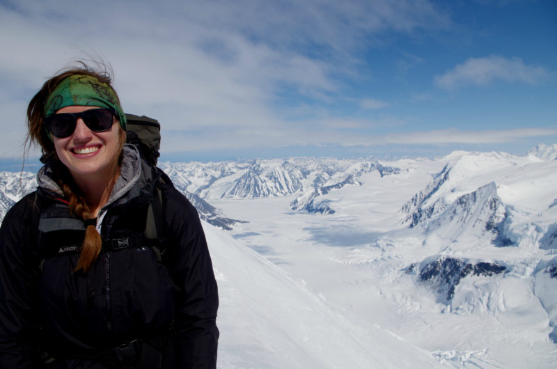
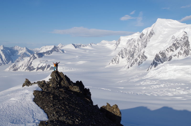
I managed to grab a picture of Sarah at the top, but was feeling too wobbly to get one of Mary too. Sorry Mary, let’s go back next year and get that picture!
We briefly considered continuing towards the south peak, this would have required down-climbing 800 feet on the exposed knife edge ridge to the ice plateau beyond. But, we just didn’t have the gear to protect it, so started down towards our camp. Sarah:
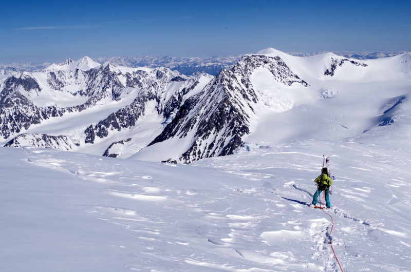
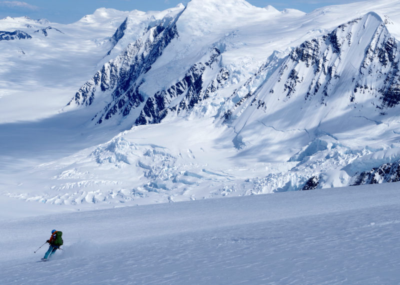
The upper pitches were a patchwork of powder and ice, which transitioned to settled powder lower down. Mary:
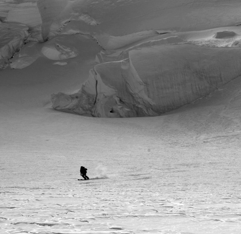
Following our skin track we worked our way down. Mary above the Matanuska Glacier:
The final pitch above the camp was the scariest. This was the crevasse zone where I had broken thru the day before, and the bridges were soft again. Our options were: 1) stay in a snowcave 500 feet above our camp; 2) rope up, proceed slowly, and put more stress on the bridges; 3) ski it quickly one by one. Settling on the third option, we were soon back at camp.
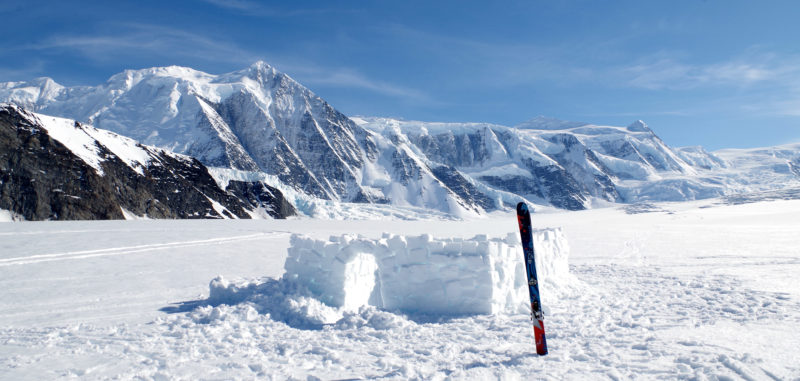
There was no way to continue lower across the sagging snow bridges that evening. Instead we sat on our warm moraine campground, watched seracs fall, enjoyed dinner, and waited for the next morning to move.
In the morning, there had been the slightest of freezes, sun induced rock fall was already rumbling around us, and several of the bridges we had crossed just days before had failed. Given the conditions, we slowly worked our way down.
At one point we stopped to drop snowballs in a crevasse we had crossed on the way up. Watching them silently disappear into the darkness, we never heard them hit the bottom. Back at the LZ we built a little shelter and called Mike.
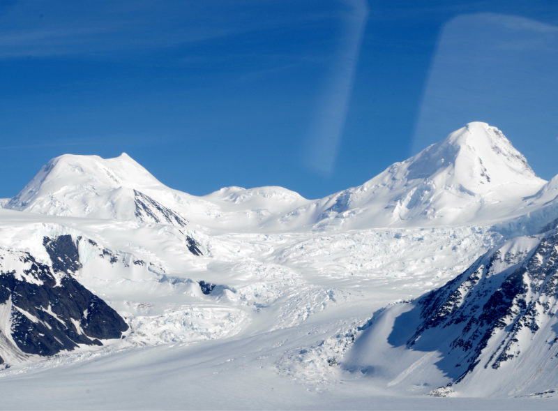
By 6 PM Meekin was on the ground remarking on what nice snow there was for landing. And he had news: our ride home had came with strings attached. He needed our help back at his shop, to make it up to us we’d be going on a flight seeing tour on the way home.
The flight went something like this: “Once I spent 40 days leading a team of horses thru this area…you all really should do a ski trip on those peaks across the way…they call that Mike Glacier because I was the first person to land there…” You get the idea.
Back at the airstrip Meekin got out a ladder, a climbing rope, a rake, and his backhoe; it was time to earn our flightseeing tour.
Mike grew up in the mountains of Colorado; after grad school he wanted to go where the nights were longer, the crevasses deeper, and the claws sharper. So, he moved to Alaska. Mike keeps his own outdoor blog at
www.mikerecords.com
Latest posts by Mike Records
(see all)
Summary
Article Name
North Markus Baker
Description
Marcus Baker has it all- remote glaciers, seracs, knife ridges, and tasty rime. Find out what it's like to climb and ski this magical mountain!
Author
Mike Records