
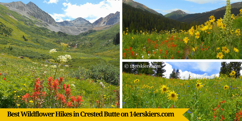
Best Wildflower Hikes in Crested Butte
(Last Updated On: )
But, where is the best place to hike? Herein lies the problem. The peak of the wildflowers fluctuates. Where they are best depends on the time of summer, and it even depends on the rate of snow-melt – which in itself can vary from year to year. But, there are patterns of progression to the wildflowers. And this article will help you decide where to hike to find the wildflowers depending on the time of summer.
Wildflowers in early to mid-June
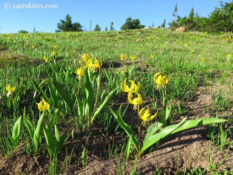
Trails may be limited in June due to snow-cover still. It is likely that most trails above tree line will still have snow. If you are wondering about snow-cover during a certain year, make sure to stop into a local outdoors shop to find out more information.
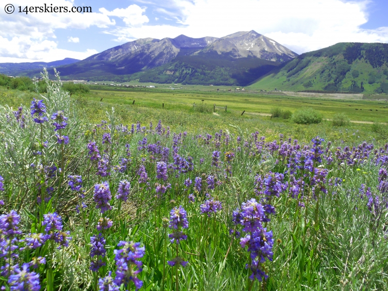
Wildflowers in late June to mid-July
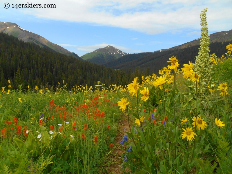
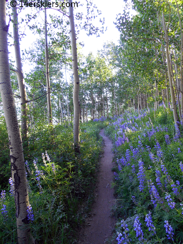
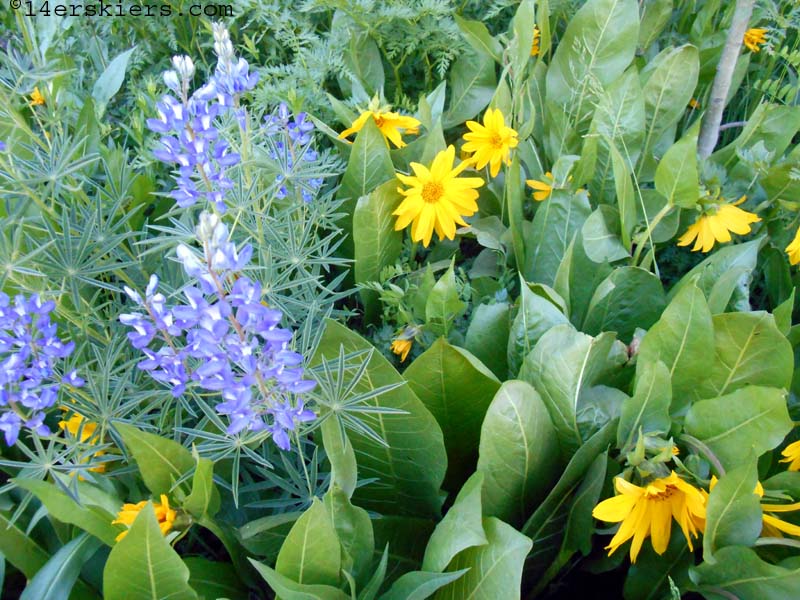
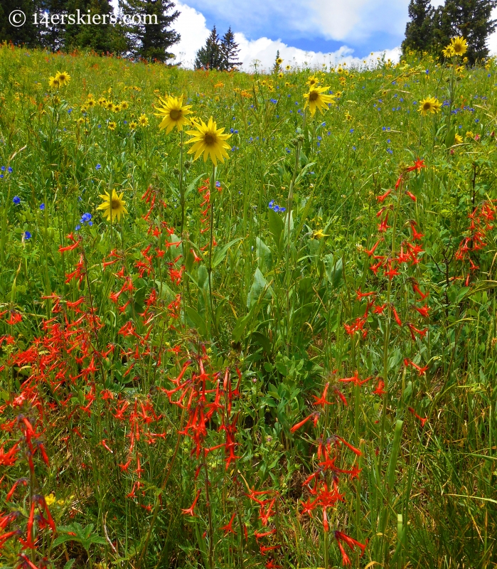
In late June and early July, the sunflowers are in their glory. You will see hues of yellow, from Aspen sunflowers to mule’s ears to sneezeweed. These will be at their best at mid-elevations, at treeline or just below. In many places, these will be heavily contrasted with scarlet gilia. Of course, there will still be plenty of blue and purple hues with larkspur, monkshood, and waning lupine. Columbine will also be present in a lot of areas.
In drier grassy/sage-brush areas different flowers may be popping out like flax and penstemon. These will likely be best on the Upper Loop, Tony’s Trail, Strand Bonus, Upper Cement Creek trail, and the East River Trail.
Wildflowers in late July to early August
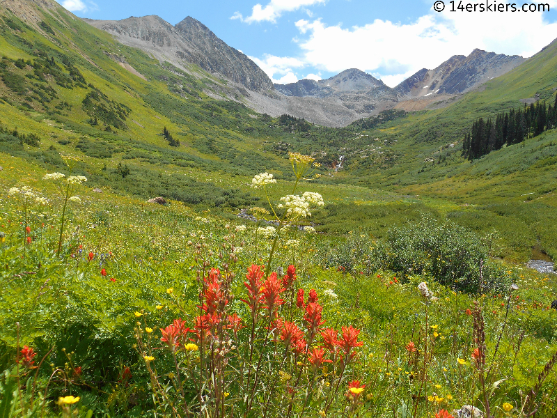
The flowers don’t get much better than up the trail from the West Maroon Trailhead. Most years, you will find wildflowers that are over your head! Head toward Rustler Gulch, West Maroon Pass, Frigid Air Pass, or Hasley Pass. If you can, drop into Fravert Basin or Hasley Basin for added wildflower goodness. The wildflowers are also spectacular on the Schofield Pass Loop.
Further away, the wildflowers will likely be great on Daisy Pass and the upper part of Oh-Be-Joyful basin towards Blue Lake.
Wildflowers in mid to late August
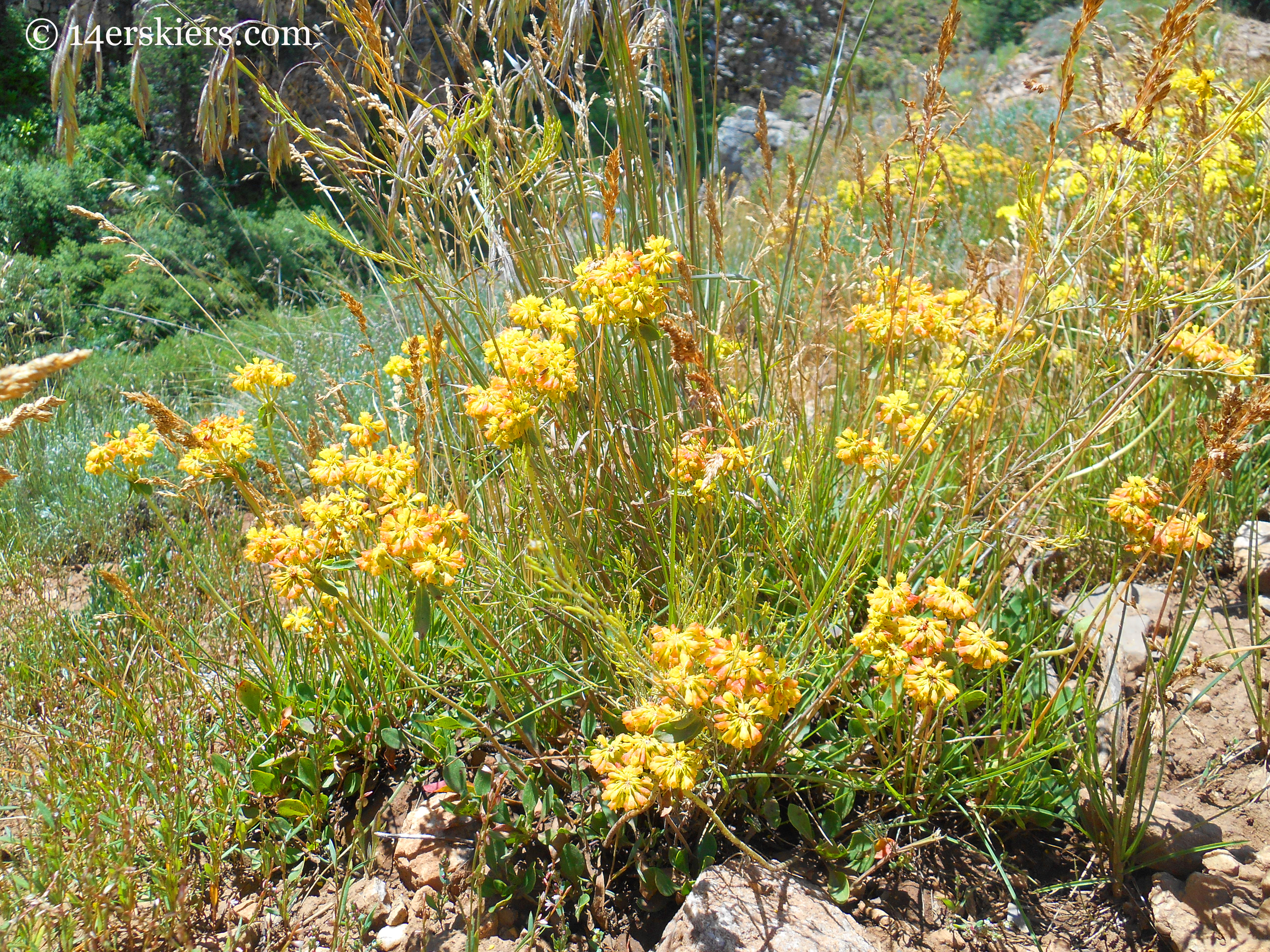
Often, there is a resurgence of flowers in the grassy/sage-brush areas. The buckwheat is particularly beautiful with its range of colors from cream to peach to orange to yellow-green to red. Try the Upper Loop, Tony’s Trail, Strand Bonus, Upper Cement Creek trail, and the Brush Creek Trail.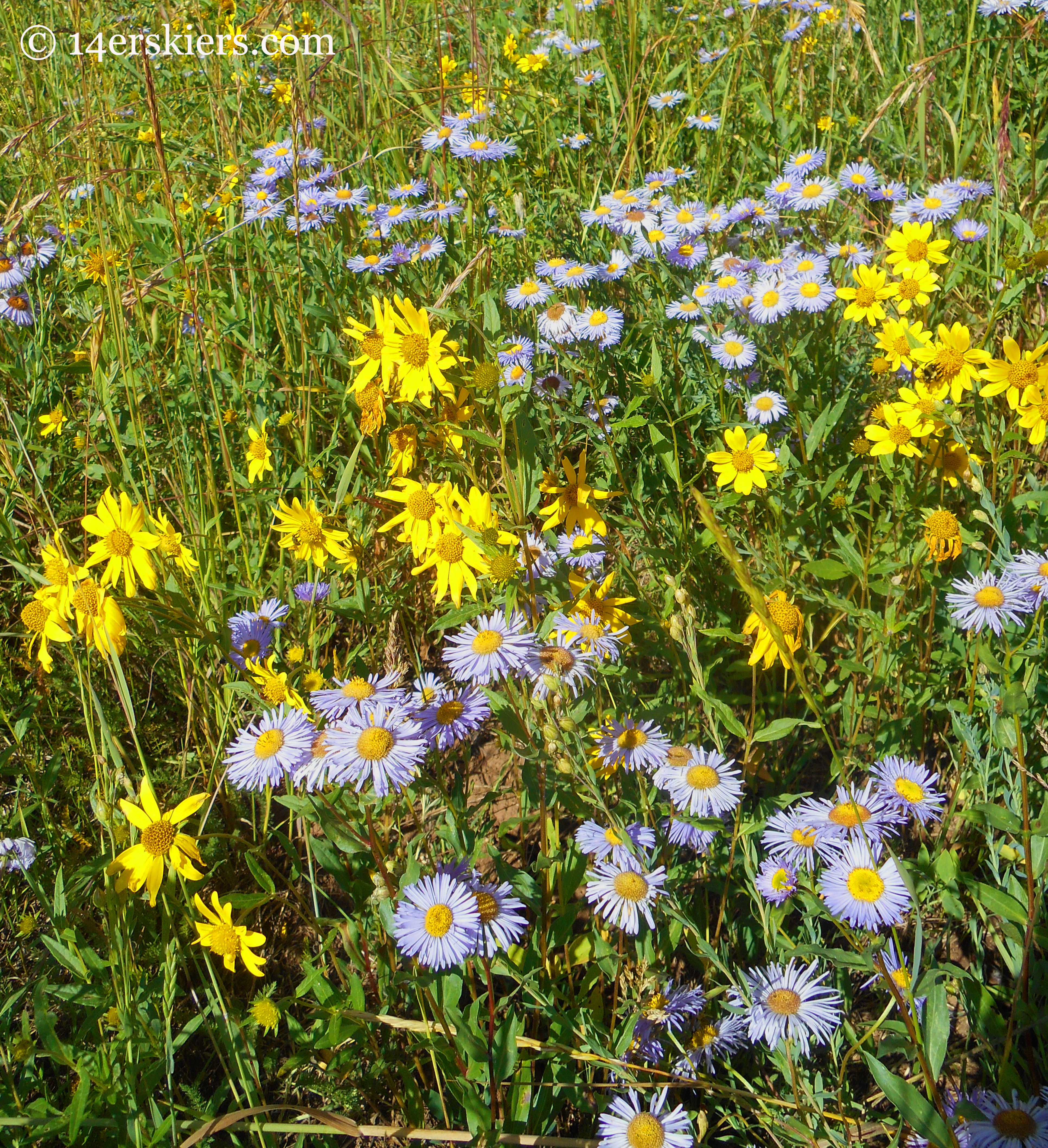
Useful Information
When possible, I have provided links to our official hiking guide. But, some of the trails I have mentioned above are not in my guide, as we tend to bike them more than hike them. If this is the case, you will find them in our biking guide. But, I have included a bit of information on them here:
- Columbine
- Lower Loop
- Lupine
- Meander
- Prospector
- Strand Bonus
- Tony’s Trail
- Upper Loop
- Upper Cement Creek Trail
To hike Columbine, park at the lot at the base of the ski area. If you would like a map, stop by the Adventure Center and they can provide a free one for you. From the bottom of the Red Lady Lift, look for a trail called Up and Away. After about a half mile, this trail will intersect with Columbine. Columbine winds upward, intersecting with Painterboy. You can keep following Painterboy, to the top of the ridge, or you can turn around. This trail is best done as an out and back. It’s about 2 miles one-way from the base to the top of the ridge.
From HWY 135, turn west onto Elk, then right onto Second, then left onto Butte Avenue. Continue on the dirt road, past Peanut Lake, to a parking lot and the start of the Lower Loop. The Lower Loop can be done as an out and back or an actual loop. From Peanut Lake, the loop is about 4 miles. See a map here. 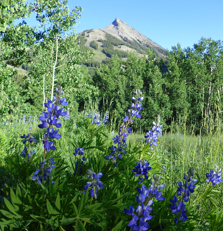
From HWY 135, turn west onto Slate River Rd. Continue a few miles until the road becomes dirt. Shortly after, the trail will be on your right. Park off the side of the road. Lupine is 2.5 miles one-way, and best done as a out-and-back.
From town, continue up HWY 135 past the base area for the ski area. Go until the road becomes dirt. You will see parking on the left side of the road. Park there, and cross to the other side of the road (east side) to begin your hike. Walk up a short dirt road for about 1 minute, then you will see Meander veering off to the left and downward. Meander is best done as and out-and-back and is about 3-miles one-way.
From town, continue up HWY 135 past the base area for the ski area. Go until the road becomes dirt. You will see parking on the left side of the road. Park there, but continue walking up Prospector Rd (which is paved) for about 1/4 mile. You will see the bottom of the Prospector lift. Continue upward, following the Prospector trail signs. Prospecter is best done as an out-and-back and is about 1.5 miles long.
From town, head south and after about a mile, turn left onto Brush Creek Road. Continue on Brush Creek Rd. The road will become dirt. At 2.5 miles, you will find the Brush Creek Trailhead, pass that and go another 1.6 miles to the bottom of the Canal Trail. Parking is limited, but park off the side of the road. To begin your hike, you will need to cross the canal and begin hiking upwards on the canal trail for .9 miles. There, turn right onto Strand Bonus. You can hike until the end of Strand Bonus (1.3 miles) and turn around. See a map of the area.
To see wildflowers, the Upper Loop is best accessed via Tony’s Trail. So, follow the directions for Tony’s Trail. Tony’s Trail intersects with the Upper Loop. There, turn left (or north). Upper Loop continues another 1.3 miles until a road, but the wildflowers will be best in the first .5 to .75 miles. Turn around when you desire and retrace your tracks back to town. See a map of the area.
From HWY 135, turn east up Cement Creek. Go 6.7 miles and you will see the parking for Deadman’s trailhead on your right. Continue onward another 1.3 miles to a big switch back in the road. The Upper Cement Creek trail starts here. Park on the side of the road, although parking is limited. The Upper Cement Creek trail is a little over 3 miles one direction and best done as an out-and-back. See map of the area.
Hiking for Wildflowers
Hopefully, you found this guide useful for determining the best wildflower hikes in Crested Butte, depending on the time of summer. Should you have any questions or information to add, please do not hesitate to contact me.
Now, get out and enjoy the flowers!
- Mount Buckskin (17 May 2020) - May 28, 2020
- Horseshoe Ski (14 May 2020) – The mountain whose journey nearly killed me - May 27, 2020
- Sayres X-Rated Ski (10 May 2020) - May 19, 2020
Great post! My husband and I were thinking of heading out to Crested Butte this weekend for Labor Day. Still good to catch wildflowers there?
Kathleen- The sunflowers are waning for sure. But, you can still find beautiful paintbrush, asters, and fleabane! It should be a gorgeous weekend!
Hi Brittany! I’m heading to CB next week! Do you have any suggestions for trails to take younger kids (mine are 3&4) where it’s not too terrible long or tough and still see wildflowers?
Hi Devita! I would recommend the Brush Creek Trail or Meander, both mentioned in this article: https://14erskiers.com/blog/2014/08/9-best-short-hikes-in-crested-butte/
Have fun! The wildflowers are off the hook!
-Brittany